Hudson River and Sound Shore Houses: What Tidal Water Changes
The water that reaches it is tidal. Both the Hudson and Long Island Sound are tidally influenced along Westchester's shore, and the water damage trade's standard grades all seawater flooding and rising river water as grossly contaminated, so a shoreline basement that took that water starts as a cleaning and removal job before it becomes a drying job.
Already know you need someone out? Call (315) 640-3590.
What a shoreline assessment settles for you
After a coastal storm, the most useful thing anyone can tell you is which water did the damage. A nor'easter can push the tide into a basement and drive rain through a window in the same night, and those are graded and handled differently. An assessment separates them, so that what comes out of the house is what the tidal water actually reached and nothing more. The county's hazard mitigation plan names the risk directly: the shoreline along the Hudson River and Long Island Sound is vulnerable to coastal flooding, both areas are tidally influenced, and low-lying areas can be hit during nor'easters and coastal storms.
Why tidal and river water change what can be saved
The S500 standard's own examples of Category 3 water include all forms of flooding from seawater and rising water from rivers or streams, alongside sewage. Its text says that after a Category 2 or 3 intrusion, remediation should come before restorative drying, with contamination controls and worker protection. For you that means soaked drywall, insulation and carpet that sat in tidal water are cleaned or removed first, and the drying equipment comes after. A dry-in-place plan is the right answer for a lot of leaks, and it is usually the wrong answer for this one.
The Sound Shore carries most of the county's flood claims
FEMA's flood insurance records, as of September 8, 2026, show how uneven the county is. The Village of Mamaroneck and the City of Rye together account for 33.5 percent of all paid flood claims in Westchester and 45 percent of the dollars paid. Nine communities on the Sound side, from Pelham Manor to Port Chester, account for 6,180 of the county's 9,938 paid claims. That is a record of insured losses, not a forecast for any one street, and we cannot tell you whether a particular address floods. It does explain why so many Sound Shore owners already know the drill.
Storm surge is the Sound's particular hazard
Surge is seawater pushed ashore by a storm, and it is the clearest case of the seawater clause in the standard. The county plan estimates that up to 3.2 percent of Westchester's building stock lies in storm surge hazard areas, and it names the City of Rye as having the most buildings in the SLOSH Category 1 through 3 inundation areas and the Village of Mamaroneck the most in Category 4. If your basement took water during a coastal storm, note the height it reached and how long it stood. Both facts go straight into the scope.
The Hudson side: tidal, with fewer claims, which is not the same as dry
The river towns have a very different claims record. FEMA's data shows eleven Hudson municipalities from Yonkers north to Peekskill with 1,010 paid claims between them, 688 of them in Yonkers, and small counts farther north. Yet the county plan lists coastal VE zones along the Hudson in places such as Ossining, Tarrytown, Croton-on-Hudson and Peekskill, and in 2021 Croton-on-Hudson told the county FEMA was preparing a revised Hudson River map with higher flood elevations and V zones. Few claims on record says little about the water that reached your basement last week.
Higher water and drains that run backward
New York's sea level rule, 6 NYCRR Part 490, puts both of Westchester's coasts in one region and projects a medium rise of 9 inches by the 2030s and 16 inches by the 2050s above a 1995 to 2014 baseline. Two waterfront villages have told the county what that means on the ground. Tarrytown listed culverts and sewers that may need protection against damaging backflow as seas and storm rain rise. Port Chester said its drainage flooding problems are likely to increase as sea level reduces drainage capacity and surcharges storm sewers. Water that comes up through a floor drain on a high tide is still tidal water.
Before you call anyone after tidal water
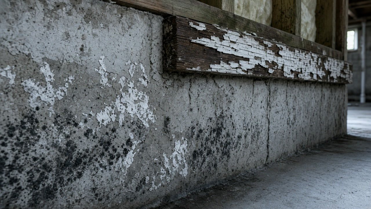
Keep it simple in the first hours. Stay out of standing water that may be contaminated, photograph the waterline on the walls, and follow EPA's warning not to run a heating or cooling system you know or suspect is contaminated with mold. Not every shoreline problem is a flood job: a roof or window leak in the same storm is not Category 3 by default, and a small patch of growth from it may be something you can clean yourself. But when the water came in off the river or the Sound, EPA's advice is to bring in someone experienced with contaminated water, and that is the job we arrange.
Sources used in this guide
The county plan states that "Westchester County's shoreline along the Hudson River and Long Island Sound are vulnerable to coastal flooding. Both areas are tidally influenced", and that "Principal sources of flooding in Westchester County include both the Hudson River and various tributaries, and the Long Island Sound. The Hudson River produces tidal flooding in low-lying shore areas."
Source: Westchester County Department of Planning, 2021 Westchester County Countywide Hazard Mitigation Plan, Section 5.4.3 Flood, accessed 2026-09-23
Table 5.3.1-1 of the county plan lists coastal high-hazard VE zones for Hudson River municipalities including Cortlandt, Croton-on-Hudson, Ossining (town and village), Peekskill, Sleepy Hollow, Tarrytown, Dobbs Ferry, Irvington and Yonkers, and for Long Island Sound municipalities including New Rochelle, Larchmont, Mamaroneck (town and village), Pelham Manor, Port Chester and Rye. White Plains, Harrison, Elmsford, Mount Vernon, Yorktown, Bedford and Mount Kisco show only riverine A-type zones (A, AE or AO) with no VE zone.
Source: Westchester County Department of Planning, 2021 Westchester County Countywide Hazard Mitigation Plan, Section 5.4.3 Flood, Table 5.3.1-1 (source FEMA 2014), accessed 2026-09-23
Two communities, the Village of Mamaroneck (1,766 paid claims, about $63.6 million) and the City of Rye (1,566 paid claims, about $59.8 million), account for 33.5 percent of all paid NFIP claims in Westchester County and 45 percent of the dollars paid, per FEMA's claims records as of September 8, 2026. Nine communities on the Long Island Sound side of the county (the Village and Town of Mamaroneck, Rye, New Rochelle, Harrison, Larchmont, Rye Brook, Port Chester and Pelham Manor) together account for 6,180 of the county's 9,938 paid claims.
Source: FEMA, OpenFEMA NFIP Redacted Claims v3 (dataset as of 2026-09-08), Westchester County, analyzed 2026-09-23, accessed 2026-09-23
The county plan estimates that up to 3.2 percent of Westchester's building stock lies in storm surge hazard areas, and that 1,490 buildings (0.6 percent) are in the SLOSH Category 1 surge area. It states that "the City of Rye has the greatest number of buildings in the SLOSH Categories 1 through 3 inundation areas and the Village of Mamaroneck has the greatest number of buildings in the SLOSH Category 4 inundation area."
Source: Westchester County Department of Planning, 2021 Westchester County Countywide Hazard Mitigation Plan, Section 5.4.3 Flood, Tables 5.3.2-12 to 5.3.2-15, accessed 2026-09-23
Per FEMA's claims records as of September 8, 2026, eleven Hudson River municipalities from Yonkers north to Peekskill (Yonkers, Hastings-on-Hudson, Dobbs Ferry, Irvington, Tarrytown, Sleepy Hollow, the Village and Town of Ossining, Croton-on-Hudson, Cortlandt and Peekskill) account for 1,010 paid NFIP claims, of which 688 are in Yonkers. North of Yonkers the counts are small: Tarrytown 22, Peekskill 32, Village of Ossining 42, Sleepy Hollow 9 and Croton-on-Hudson 9 paid claims across the life of the program.
Source: FEMA, OpenFEMA NFIP Redacted Claims v3 (dataset as of 2026-09-08), Westchester County, analyzed 2026-09-23, accessed 2026-09-23
The Village of Croton-on-Hudson told the county in 2021 that its maps adequately address flood risk "except for the Hudson River since FEMA is in the process of issuing a revised flood hazard map for the Hudson River which will include higher flood elevations and V zones", and that the Hudson River shoreline, the Croton River valley and "various smaller stream channels that are not mapped as SFHA" are prone to flooding.
Source: Westchester County Department of Planning, 2021 Westchester County Countywide Hazard Mitigation Plan, Section 9.28 Village of Croton-on-Hudson, accessed 2026-09-23
The ANSI/IICRC S500 water damage standard, as quoted by its consensus body, defines Category 3 water as "grossly contaminated" water that "can contain pathogenic, toxigenic or other harmful agents", with examples that include "sewage; waste line backflows that originate from beyond any trap regardless of visible content or color; all forms of flooding from seawater; rising water from rivers or streams".
Source: ANSI/IICRC S500 Consensus Body, Position Statement: Category of Water Damage and Weather-related Events, March 16, 2026 (citing ANSI/IICRC S500, 5th Edition, 2021), accessed 2026-09-23
The S500 text quoted in the consensus body's statement says that if the water is Category 1 the restorer can proceed without contamination controls, but "With regard to Category 2 or 3 water intrusions, remediation should occur prior to restorative drying and restorers shall use contamination controls and appropriate worker protection."
Source: ANSI/IICRC S500 Consensus Body, Position Statement: Category of Water Damage and Weather-related Events, March 16, 2026 (citing ANSI/IICRC S500, 5th Edition, 2021), accessed 2026-09-23
New York's sea level rise regulation, 6 NYCRR Part 490 as amended in 2024, places both of Westchester's coasts in one region: the Lower Hudson-New York City Region covers "the main stem of the Hudson River, south from the mouth of Rondout Creek at Kingston" and "the Long Island Sound in Westchester County". For that region the medium projection is 9 inches by the 2030s, 16 inches by the 2050s and 30 inches by the 2080s above the 1995 to 2014 baseline.
Source: New York State Department of Environmental Conservation, 6 NYCRR Part 490 Projected Sea Level Rise, Express Terms (adopted 2024), accessed 2026-09-23
Tarrytown's annex lists as a vulnerability that "With the rise of sea levels/storm surge/storm rainwater increasing, culverts and sewers may require protection to prevent damaging backflow", and records an April 13, 2020 wind storm with trees down and sewer back up.
Source: Westchester County Department of Planning, 2021 Westchester County Countywide Hazard Mitigation Plan, Section 9.45 Village of Tarrytown, accessed 2026-09-23
The Village of Port Chester told the county that "Byram River bulkheads require replacement and raising to provide protection in light of sea level rise", and that it "is impacted by drainage related flooding. Problems are likely to increase due to the impacts of sea level rise as it relates to reduced drainage capabilities and the surcharging of storm sewers." It named flood-prone areas at Abendroth Avenue and Westchester Avenue, Boston Post Road, Fox Island Road, and Willett Avenue and Broad Street.
Source: Westchester County Department of Planning, 2021 Westchester County Countywide Hazard Mitigation Plan, Section 9.41 Village of Port Chester, accessed 2026-09-23
EPA advises that if the moldy area is less than about 10 square feet, "in most cases, you can handle the job yourself", but "If the water and/or mold damage was caused by sewage or other contaminated water, then call in a professional who has experience cleaning and fixing buildings damaged by contaminated water." It also warns: "Do not run the HVAC system if you know or suspect that it is contaminated with mold."
Source: U.S. Environmental Protection Agency, Mold Cleanup in Your Home, accessed 2026-09-23
In a March 16, 2026 position statement the ANSI/IICRC S500 Consensus Body states: "Top-down water ingress, wind-driven rain and water from weather related events are not automatically considered Category 3 Water." It says the category is set by a "preliminary determination" made by the restorer after inspection and information gathering.
Source: ANSI/IICRC S500 Consensus Body, Position Statement: Category of Water Damage and Weather-related Events, March 16, 2026 (citing ANSI/IICRC S500, 5th Edition, 2021), accessed 2026-09-23
Services this guide relates to
Need someone to look at it?
Send the details and we will come back to you.